- Популярные видео
- Авто
- Видео-блоги
- ДТП, аварии
- Для маленьких
- Еда, напитки
- Животные
- Закон и право
- Знаменитости
- Игры
- Искусство
- Комедии
- Красота, мода
- Кулинария, рецепты
- Люди
- Мото
- Музыка
- Мультфильмы
- Наука, технологии
- Новости
- Образование
- Политика
- Праздники
- Приколы
- Природа
- Происшествия
- Путешествия
- Развлечения
- Ржач
- Семья
- Сериалы
- Спорт
- Стиль жизни
- ТВ передачи
- Танцы
- Технологии
- Товары
- Ужасы
- Фильмы
- Шоу-бизнес
- Юмор
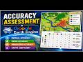
How to Join Population Data in Excel With Shapefile in QGIS
#QGIS #Excel #Shapefile #PopulationData #GeospatialAnalysis #GIS #DataAnalysis
Learn how to join population data from an Excel spreadsheet to a shapefile in QGIS—step by step. In this tutorial, you’ll prepare your Excel table, confirm matching key fields, and clean data so it joins correctly. Then we’ll import the shapefile into QGIS, open the attribute table, and perform the table join to attach population values to the right geographic features. Perfect for beginners and GIS analysts who want faster, more accurate workflows.
Buy me a coffee here: https://buymeacoffee.com/geojay
Code link: https://code.earthengine.google.com/1765b96655fd63e454494a19b2a54bb4
Join our membership: https://www.youtube.com/channel/UC1644b8coktC6jyLL7ciDXA/join
For business and enquiries: WhatsApp+2347065365193 or Email: geojaygis@gmail.com
WhatsApp Group: https://chat.whatsapp.com/CvvLBo7YisgIClQgzL7WOa
Facebook Group: https://www.facebook.com/share/g/1Fn4oQzn1L/
Related videos
Many ways to get coordinates of point features in QGIS: https://www.youtube.com/watch?v=FiXkmXuQEIs
Extract Lat and Long Coordinates in D° M' S" in QGIS: https://www.youtube.com/watch?v=8G8BPQdkSIA
QGIS, join population data, join excel to shapefile, excel to shapefile, QGIS tutorial, GIS tutorial, geospatial analysis, population mapping, demographic mapping, attribute table, spatial join, table join, join data in QGIS, QGIS joins, QGIS geoprocessing, GIS workflow, mapping tutorial, how to join data, GIS data preparation, clean data, data matching, key fields, ID matching, shapefile join, shapefile attributes, Excel spreadsheet, data import, data visualization, choropleth map, population choropleth, thematic mapping, join attributes, field types, troubleshooting QGIS, fix join errors, missing records, duplicate IDs, QGIS beginners, QGIS for beginners, GIS for beginners, learning GIS, spatial data, geographic data, data integration, geodata, QGIS join guide, attribute join, data engineering for GIS, location data, mapping with QGIS, admin boundaries, census data, demographic data, GIS analysis, spatial analysis, data-driven mapping, geospatial technology, SIG, GIS software, open source GIS, QGIS tips, QGIS tricks, QGIS workflow tips, spatial data science, data science GIS, career in GIS, GIS mapping project, join tables in QGIS, merge data in QGIS, synchronize datasets, exporting maps, styling layers, map visualization, color ramp, legend, map layout, print map, QGIS layout, QGIS report, geospatial tutorial, Excel QGIS workflow, population statistics, census boundaries, join by field, transform data, import CSV to QGIS, Excel cleanup, QGIS attribute join, QGIS shapefile, QGIS excel join, geospatial data analysis, spatial join tutorial, GIS mapping basics, GIS data join, learning QGIS fast, step by step GIS, beginner QGIS series, QGIS data management, QGIS attribute editing, field calculator, verifying join results, debugging GIS joins, practical GIS tutorial, mapping demographics, population analysis, geospatial dashboard, GIS education, tutorial video, educational GIS content
Видео How to Join Population Data in Excel With Shapefile in QGIS канала Geojay GIS Solution
QGIS join population data join excel to shapefile excel to shapefile QGIS tutorial GIS tutorial geospatial analysis population mapping demographic mapping attribute table spatial join table join join data in QGIS QGIS joins QGIS geoprocessing GIS workflow mapping tutorial how to join data GIS data preparation clean data data matching key fields ID matching shapefile join shapefile attributes Excel spreadsheet
Комментарии отсутствуют
Информация о видео
21 мая 2026 г. 17:00:39
00:09:47
Другие видео канала