- Популярные видео
- Авто
- Видео-блоги
- ДТП, аварии
- Для маленьких
- Еда, напитки
- Животные
- Закон и право
- Знаменитости
- Игры
- Искусство
- Комедии
- Красота, мода
- Кулинария, рецепты
- Люди
- Мото
- Музыка
- Мультфильмы
- Наука, технологии
- Новости
- Образование
- Политика
- Праздники
- Приколы
- Природа
- Происшествия
- Путешествия
- Развлечения
- Ржач
- Семья
- Сериалы
- Спорт
- Стиль жизни
- ТВ передачи
- Танцы
- Технологии
- Товары
- Ужасы
- Фильмы
- Шоу-бизнес
- Юмор
USGS DEM Download Demo
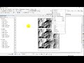
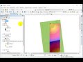
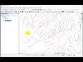
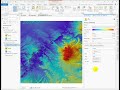
Demonstration using the National Map Data Download Application from the USGS.
Downloading 10m data, inspecting properties, and identifying issues with rasters in geographic coordinate systems.
1st in a series of demonstrations walking through the raster data prep steps needed before 'combining' in a model.
Recorded in ArcGIS Pro 3.6.1
Part of USU's geospatial program: usu.edu/geospatial/
Part 2: Projecting Rasters: https://youtu.be/O03FBcIYYLY?si=gQzc7rPS_0DTGF7c
Part 3: Mosaic to New Raster: https://youtu.be/qkcgXqbfCDU?si=LW5h_wtX7iWrErdT
Part 4: Resampling (to change cell size) and enforcing concurrency: https://youtu.be/QvbiwOHspx4?si=h9edH-Ny9wk50J9g
Part 5: Reclassifying and Raster Calculation: https://youtu.be/Ib6KAvvoqCA?si=gFglMmIRZROYqq-Q
Видео USGS DEM Download Demo канала Shannon Belmont
Комментарии отсутствуют
Информация о видео
4 апреля 2026 г. 4:03:01
00:10:57
Другие видео канала