- Популярные видео
- Авто
- Видео-блоги
- ДТП, аварии
- Для маленьких
- Еда, напитки
- Животные
- Закон и право
- Знаменитости
- Игры
- Искусство
- Комедии
- Красота, мода
- Кулинария, рецепты
- Люди
- Мото
- Музыка
- Мультфильмы
- Наука, технологии
- Новости
- Образование
- Политика
- Праздники
- Приколы
- Природа
- Происшествия
- Путешествия
- Развлечения
- Ржач
- Семья
- Сериалы
- Спорт
- Стиль жизни
- ТВ передачи
- Танцы
- Технологии
- Товары
- Ужасы
- Фильмы
- Шоу-бизнес
- Юмор
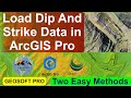
Geological Map Digitization in ArcGIS Pro – Part 2 | GeoSoft Pro | Step-by-Step Guide
📄 Description:
Welcome to Part 2 of our ArcGIS Pro tutorial series on Geological Map Digitization!
In this video, you'll learn how to digitize a scanned geological map directly in ArcGIS Pro, including the creation of shapefiles for lithologies, faults, and other geological features.
📌 Watch the previous parts and related videos:
➡️ Part 1 – Introduction & Workflow:
https://youtu.be/D1v9EnItowo?si=zBfBxYXv1cWM7grR
➡️ Georeferencing a Geological Map in Global Mapper:
https://youtu.be/xjit1WgnosY?si=T7r8PevHL0Oe_Hlz
➡️ ArcGIS Pro & Required Software Installation (LinkedIn):
https://www.linkedin.com/posts/muhammad-suliman-a7b454206_arcgispro-gis-geosoftpro-activity-7327246212498124800-4bz5?utm_source=share&utm_medium=member_desktop&rcm=ACoAADRkRf8B_T8os5XD_h2qQsmDsUH274Ziy0A
➡️ Global Mapper Installation:
https://youtu.be/ReUQVgva3wI?si=27OGKhJrTHTHGn8L
🎯 In This Tutorial You’ll Learn:
• How to georeference scanned geological maps (if not already done)
• How to digitize lithological units, faults, and contacts in ArcGIS Pro
• How to create and edit shapefiles
• How to apply symbology and styling for geological layers
🛠️ Software Used:
• ArcGIS Pro
🎓 Ideal for:
• Geology and GIS students
• Geoscientists working with scanned paper maps
• Beginners in digital geological mapping
👍 Like, comment, and subscribe for more practical geoscience and GIS content!
Видео Geological Map Digitization in ArcGIS Pro – Part 2 | GeoSoft Pro | Step-by-Step Guide канала GeoSoft Pro
ArcGIS Pro tutorial Geological map digitization Digitizing geological maps Georeferencing geological maps GIS for geologists ArcGIS Pro shapefiles Geological mapping Geology in ArcGIS Pro Pakistan geology Mapping lithologies Geological education Geological interpretation ArcGIS Pro for students Geological software tutorial Geoscience mapping tools
Комментарии отсутствуют
Информация о видео
15 мая 2025 г. 8:32:54
00:54:10
Другие видео канала